Saturday, June 24, 2017

LeConte Glacier and Petersburg

One of the excellent but lesser booked tours that we offer is an 8 hour adventure to LeConte Glacier and the scenic town of Petersburg.  This trip gives you the opportunity to experience one of the most truly magnificent and humbling sights you can see while in Alaska, a massive river of ice meeting the sea in a rumbling and beautiful chaos of sound.  If the wilderness coastline of Southeast Alaska with its mountains reaching from sea to sky hasn't impressed you, being amidst the floating icebergs while staring up at the shear rock faces sculpted smooth by ice certainly will!  If this still doesn't do it for you, then as a last resort you can mix yourself a cocktail with a piece of clear, pure ice thousands of years old while the rest of us try to spot mountain goats clinging to the cliffs or photograph the endless shades of blue found in the icebergs.


LeConte Glacier is named for Joseph LeConte who was a geology professor at the University of California in Berkely in the late 19th century but never visited his namesake bay and glacier.  There seem to be two opinions as to the correct pronunciation of LeConte.  Some people pronounce it La Cont, others La Cont Ee, tomato, tomahto, pronounce it however you like!  Regardless of your preferred pronunciation, it is a worthwhile place to experience. 
Prior to it being called LeConte Bay, the Stikine Tlingit referred to it as Thunder Bay due to the rumbling echoes of the calving glacier and their belief that these sounds were made by the legendary thunder bird of Tlingit lore flapping its wings.


LeConte Glacier is a tidewater glacier meaning that it goes straight from its origin high up in the Stikine Ice Field all the way down to the sea where its dense freshwater ice slowly melts into the briny deep.  Being a tidewater glacier, LeConte is  greatly affected by tidal action making it a very active glacier particularly when the tidal changes are extreme. The frequency and amount of calving icebergs that fill the bay make this a continually changing environment that is never the same from one day to the next or even one hour to the next and presents a true labyrinth of ice sculptures guarding access to the face of the glacier. 


LeConte Glacier is also known for its calving of icebergs from beneath the surface of the water.  The water near the face of the glacier is 800 feet deep on average giving an enormous amount of ice to potentially calve off and shoot to the surface causing a phenomenon known as "shooters".  A word from the wise- Don't get too close!  Even if you carefully watch out for ice falling from above, those lurking submarine icebergs can get you with no warning whatsoever.  A minimum of a half a mile from the face is a pretty good standard to hold to, any closer and you are flirting with some serious icy danger. 
LeConte Bay is also known for the fact that it is a birthing ground, or pupping ground, for harbor seals.       


The usually densely packed ice in the bay provides these seals with a relatively safe place to give birth and raise their pups without an imminent threat from predatory killer whales or harassing humans.  It is uncommon to see another boat in the entire bay on a visit to this glacier which provides these mother seals a tranquil opportunity to nurse and the pups an opportunity to grow which they do very quickly on mother's milk containing 40-50% fat.  Pups are born in June here in the bay and are weaned 4-6 weeks later.  At birth, harbor seals are about 3 feet long and weigh 20 pounds or so growing to 6 feet and 250 pounds when they reach adulthood.  Our captains do their best to maintain the voluntary regulatory distance of 500 yards from mother seals with pups but the ice dictates where the leads are so we occasionally have to get closer which allows for some photography opportunities of these beautiful animals. 

LeConte Bay isn't all ice and seals though, there is incredible scenery including a waterfall cascading for thousands of feet into the bay, mountain goats traverse the high cliffs and sometimes the low cliffs, and the occasional pod of killer whales patrol the bay looking for unwary seals.  The extraordinary diversity of ice shapes and colors within the bay can keep a person entertained and thrilled for hours.


Don't forget, there is still more to this trip!  You also get to spend some time in the town of Petersburg which owes its existence to the ice of LeConte Glacier, the fishing grounds of Frederick Sound, and the ambition of its founder, Peter Buschmann who took advantage of the easily accessible ice to start a fish cannery at this site.  Petersburg has a rich Norwegian history and heritage that is obvious when you walk through town and notice the distinct artwork and Norwegian names of streets and businesses reflecting this Nordic ancestry.

The harbors of Petersburg are an interesting place to spend some time browsing the large and diverse fleet of fishing and recreational vessels.  Petersburg's economy is primarily driven by fishing and is obvious from the beautiful but hardworking seiners, tenders, gillnetters, trollers, and other boats used to bring in the catch to the waiting canneries. 
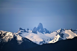
There are also some incredible vistas of the mainland mountains across Frederick Sound from Petersburg where you might be lucky enough to get view of Devil's Thumb, an internationally known vertical granite spire sitting on the border of Alaska and Canada. 


As a final enticement to make this trip even more enjoyable, you never know when it will turn into an impromptu whale watching tour.  The waters of Frederick Sound are well known for their population of whales so a sighting of distant spouts could lead to an encounter with humpbacks bubble feeding, breaching, or just cruising from one fishing ground to another.


Sunday, May 7, 2017

Whale Watching Practice

We here at Alaska Charters and Adventures are primarily known for our excellent, personalized trips to the world famous Anan Wildlife Observatory, LeConte Glacier, and of course, the Stikine River, but we also offer professionally guided whale watching trips to some of the best whale locations in the area.  John and Bob are our knowledgeable and experienced whale watching captains who are year round residents of Wrangell with thousands of hours on the water.  They are also avid amateur photographers who know how to set you up for that lifetime shot. 
I had an opportunity to practice and hone my whale watching captain skills this weekend on a personal trip to the deep waters of Clarence Strait about 45 minutes from Wrangell by boat.  Clarence Strait is one of the bigger bodies of water near Wrangell and can be intimidating place to navigate in but can also be flat and calm as a catfish pond.  Sea conditions for us were somewhere in between, closer to the catfish pond than the cold, frothy death at the other end of the scale and it was partly sunny and slightly warm so made for a pretty nice trip.
Clarence Strait is a great place to see whales, it might take some searching but there are nearly always whales somewhere out there.  Humpback whales are the most commonly seen whales here and are the most exciting to watch as they tend to be fairly active and acrobatic breaching and flipper and tail slapping or maybe bubble feeding in cooperative groups to herd schools of feed fish.  They can also be quite vocal and if near enough to the boat, you can nearly feel the vibrations of their communication in the hull of the boat.  Sea otters, Killer whales and Dall's Porpoise are not uncommon to see out there either..

Here are some examples of what you may see if you book a whale watching tour with us.  Please be easy on the photographer, he is an amateur!


The series of photos above are of a humpback whale calf enjoying a sunny morning with its mother in Clarence Strait.  It really seemed to be having a good time slapping the water and rolling over on its back while its mother kept watch close by.  I couldn't guess how many whales I've seen during my years here, thousands?, but I have never gotten bored with seeing them.  If you have a chance during a trip to Alaska, going on a whale watching tour somewhere is a worthwhile excursion.


If only this one wasn't blurry! 


The whale above put on quite an amazing show for quite some time!  The weather and water conditions had deteriorated significantly so we had to ride out some 5-6' seas and howling wind to get these few good shots.  This guy breached at least 20 times and "spyhopped" several times as well.  These were some of the worst possible conditions for photography but we were able to get several shots that we were happy with.  Another successful trip and one that has gotten me excited for sharing experiences like this with our clients.
Whales are one of the many aspects of Southeast Alaska that make this place so special and unique in the world.  We'd be happy to help you find this out for yourself!

Monday, May 1, 2017

Stikine River Birding Festival 2017

Another successful Stikine River Birding Festival just ended here in Wrangell yesterday marking the end of April and the beginning of May.  I don't know what the official numbers of visitors for the festival are but it was noticeable that there were new faces in town during the week specifically here for the event with several bird enthusiasts visiting Wrangell first on their way further north following their own migratory paths to keep up with the journeying birds. 
Here at Alaska Charters and Adventures, we had a successful festival with two incredible birding tours up the Stikine River with some very fun and knowledgeable birders from as far away as Colorado.  The events of the festival were well attended and we had a winning entry in the photo contest!  One of our birder clients was able to add a species to her life list with her first sighting of a small flock of Greater White-fronted Geese mixed in with a larger flock of Canada Geese.  There were two separate flocks of Snow Geese on the delta with one flock of thousands very close to the water where we could get some very close viewing and photography.  Shorebirds were present as well but not yet in the large numbers that will show up any day now.  Western sandpipers and Black Turnstones are around in some numbers with a few Ruddy Turnstones and Dunlins mixed in as well as some others I'm sure.


Bob Armstrongs's presentation on taking video of wildlife and birds was particularly interesting, informative, and just cool.  He gave us several new ideas on how to use GoPros as well as some new information to pass along to future clients.


Some other interesting bird sightings we saw while on bird tours were:  Rufous Hummingbirds, dozens and dozens of Bald Eagles still scooping up the last of the hooligan run, Savannah Sparrows, Golden Crowned Sparrows, a Kestrel, the first Tree Swallow of the year, hundreds of Western Grebes out on the saltwater, Surf Scoters, Barrow's Goldeneyes, Marbled Murrelets, Common Loons, and a rare sighting of a Rough Legged Hawk flying up the Stikine. 
We also saw our first bear of the year on one of our tours, a black bear sow with two small cubs of the year (COYs) down on the beach of one of the islands at the edge of the Stikine delta.


There was one Ruddy Turnstone and 2 Dunlins mixed in with this flock of Black Turnstones at City Park.


This was the winning entry in the "Other Birds" category for the photo contest entered by one of our guides.  Get out there and see stuff! 


Thursday, February 9, 2017

Tides and Tide Books

I am going to simplify the mechanism behind the phenomenon of tides to avoid making this a very lengthy post and just say that tides are caused by the gravitational pull of both the moon and the sun on the earth.  The moon, being much closer to the earth than the sun, has a much greater effect on the tides than does the sun but the sun does contribute some influence.  The proximity of the moon in relation to the earth is the main factor in determining the tidal range which is the difference between the high and the low tides as well as other things such as geographical features. 
Typically, there are two high and two low tides per day with a roughly 6 hour period of time between each high and low tide, it is actually a little bit more than 6 hours but rounding to 6 suits our purposes just fine.  Here in the Wrangell area, our biggest tidal range is about 24 feet with the smallest being about 4 feet while the biggest tidal range in the world is found on the east coast of Canada in the Bay of Fundy which is between the provinces of New Brunswick and Nova Scotia, aye.  24 feet is a lot of water but is less than half of what the Bay of Fundy sometimes gets - there is a maximum tidal range of 55 feet there!  These are the extreme ranges and occur only a few times a year but even a modest change of 4 feet can cause a person some problems if they do not properly plan for it.


So, how does a person plan for the tide?  With a tide book available for free from several local businesses in Wrangell!  (or whichever town you are in)  Since they are free and a very important reference book for anyone planning on boating, beachcombing, or really anything involving the ocean, most folks have several tide books in various places - in each boat and vehicle, float coat pockets, randomly scattered on countertops and desks, in backpacks, pretty much as many places as possible because you still sometimes can't find one when you want one!

Here are a few examples of tide books from Wrangell.


Now that you have a tide book, you probably should know how to read it so I'll make an attempt to do that now in as simple a way as possible.

Step 1:  make sure your tide book is for the correct year.  You can find that information on the front cover and on virtually every page inside the book.
Step 2:  open the book and find the appropriate district for your location
Step 3:  once you have found your district, find the page with the appropriate month for which you want to check the tide


Did you find that information at the top of the page in the above photo?  Very good, now on to the next steps.

Step 4:  you can see 3 columns on the page, the leftmost one contains the date and day of the month, the next has a heading of High February, meaning high tides in the month of February, and the last is Low February, meaning low tides in the month of February.  These columns are then divided into subcolumns of A.M. (morning), P.M. (after noon), and time and FT for feet (like the measurement not the things below your ankles).  To minimize confusion as much as possible, the P.M. tides are printed in bold print. 
Still there?  Hello?  Anyone?

Step 5:  find the particular day that you want to know the tide for.  I will use Wednesday, February 8th for this demonstration since that is what day I am doing this.  Find it?  Good. 

Step 6:  Now as you go across the 8 Wed row, you will see a big black dot which you should ignore for now, then you will come to 10:34 and then 17.7.  Looking at the top of the column shows you that the 10:34 is the time in the morning and the 17.7 is the amount of feet.  Looking further toward the top of the page shows you that you are in the High February column so you just discovered that at 10:34 a.m. on Wednesday, February 8th, there is a 17.7 foot high tide.  Got it?  It's not so hard right?
Keep moving to the right in that same row and you find in bold type, 11:34 15.5.  You are still in the High February column so you now know that at 11:34 tonight there will be a 15.5 foot high tide.  You have now mastered finding the high tide on Wednesday, February 8th!  (If you are a little confused just keep repeating these steps over and over until you get it or throw the book across the room)


Step 7:  to find the low tide, keep moving to the right on the same row until you are in the Low February column.  This works the same way as the High tide column.  Did you figure out that at 5:09 p.m. there will be a -1.9 low tide?  Why is the -1.9 green?  And what does -1.9 feet mean?  The green identifies the tides that are minus tides meaning that they are lower than the average low tide which would read as 0.0.  Just know that a minus low tide is a very low tide and you'll be fine.

Here is what that 17.7 foot high tide looked like at 10:34.


After 10:34 a.m., the tide will slowly start to go out again, or ebb, until it reaches that 5:09 p.m. low tide at which point it will then start to slowly come back in again, or flood.  An incoming tide is also called a flood tide, an outgoing tide is called an ebb tide.  "Ebb" could be a useful Scrabble word.

At 5:09 p.m., that -1.9 low tide looked like this.


With just some simple math, we can determine that between 10:34 a.m. and 5:09 p.m., there was 19.6 feet of change in the amount of water surrounding Wrangell - a 17.7 foot high tide goes down to that 0.0 average low tide level plus an additional 1.9 feet for the minus tide.  19.6 feet is a lot of water!  Knowing this information can tell you things like what sea conditions will be like in certain bodies of water, where and when to go fishing, if it is a good day to go clam digging, or how and where to anchor your boat so that it will still be afloat when you need it to be.


This works the same regardless of where you are in the world and the photo below is of a tide book from New Zealand showing all of the same information except that the unit of measurement is in meters instead of feet.


Hopefully this was informative and helpful and that you learned something new.  That was the goal anyway!  The next time we discuss tides, we'll get into the Rule of 12s which tells you how much water is still coming in or going out at any point in the tide cycle.